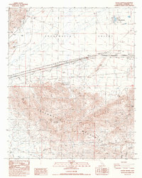
1986 Map of Desert Center
USGS Topo · Published 1986About this map
Desert Center serves as a vital oasis along the southern California corridor in the mid-1980s, positioned where the Chuckwalla Valley meets the high peaks of the Eagle Mountains. This survey illustrates a desert landscape defined by both conservation and extraction, featuring the Edmund C Jaeger Nature Sanctuary alongside numerous industrial footprints. The map details a history of prospecting with the Red Cloud Mine, Lost Pony Mine, and Granite Mine scattered throughout the southern highlands. Water sources remain critical landmarks for navigation and settlement in this arid environment, evidenced by the development at Lake Tamrisk and the presence of natural points like Corn Springs and Aztec Well. Low-lying drainages including Dragon Wash and Red Cloud Wash further define the terrain, illustrating the natural watercourses that shaped early travel and mining activity in the Chuckwalla Mountains.
Find a feature on this map
30 named features on this map. Tap any name to fly to it.
Don’t see what you’re looking for? This feature index may not catch every label — zoom into the map to look around manually.
Map Details
Editions of this 1986 Desert Center Map
This is the sole edition of this map. No revisions or reprints were ever made.
Other maps of this area

1940 · Canyon Spring
USGS Topo · 1:62,500

1943 · Canyon Spring
USGS Topo · 1:62,500

1943 · Coxcomb Mountains
USGS Topo · 1:62,500

1944 · Eagle Tank
USGS Topo · 1:62,500

1944 · Chuckwalla Mountains
USGS Topo · 1:62,500

1944 · Coxcomb Mountains
USGS Topo · 1:62,500

1954 · Salton Sea
USGS Topo · 1:250,000

1955 · Salton Sea
USGS Topo · 1:250,000

1959 · Salton Sea
USGS Topo · 1:250,000

1963 · Salton Sea
USGS Topo · 1:250,000