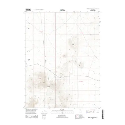
2014 Map of Desert Mountain Pass
USGS Topo · Published 2014About this map
Desert Mtn and the strategic Desert Mountain Pass anchor this high-desert landscape in Juab County. The region is defined by its arid drainage systems, including Erickson Wash and South Pine Wash, which cut through the open basins between isolated heights. A network of remote desert roads, such as the Weiss Hwy and Golden Hwy, suggests the vital importance of these transit corridors in connecting the West Desert's vast townships.
Find a feature on this map
18 named features on this map. Tap any name to fly to it.
Don’t see what you’re looking for? This feature index may not catch every label — zoom into the map to look around manually.
Map Details
Editions of this 2014 Desert Mountain Pass Map
This is the sole edition of this map. No revisions or reprints were ever made.
Other maps of this area

1885 · Sevier Desert
USGS Topo · 1:250,000

1953 · Delta
USGS Topo · 1:250,000

1955 · Indian Springs
USGS Topo · 1:24,000

1958 · Delta
USGS Topo · 1:250,000

1962 · Delta
USGS Topo · 1:250,000

1962 · Lynndyl
USGS Topo · 1:62,500

1963 · Dutch Peak
USGS Topo · 1:24,000

1963 · Cherry Creek
USGS Topo · 1:24,000
1971 · Erickson Knoll
USGS Topo · 1:24,000

1971 · Desert Mtn Pass
USGS Topo · 1:24,000