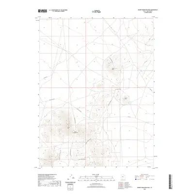
2020 Map of Desert Mountain Pass
USGS Topo · Published 2020About this map
Desert Mountain Pass serves as a critical geographic notch in the high desert of Juab County, marking a transit point through the isolated elevations of Desert Mtn. The landscape is defined by its arid character and scattered geological formations, including the Allison Knolls to the north and Coyote Knoll to the east. This 2020 survey illustrates a modern network of desert access routes that facilitate movement through this remote basin, such as the Jericho Callao Rd and Weis Hwy. Water resources are sparse, represented primarily by the Coyote Knoll Reservoir, which highlights the importance of managed catchment in this environment. The map provides a detailed view of the sectional divisions and the varied unpaved roads, including W Desert Mountain Road 4 and Coyote Knoll Road 8, which trace the base of the mountains and knolls.
Find a feature on this map
17 named features on this map. Tap any name to fly to it.
Don’t see what you’re looking for? This feature index may not catch every label — zoom into the map to look around manually.
Map Details
Editions of this 2020 Desert Mountain Pass Map
This is the sole edition of this map. No revisions or reprints were ever made.
Other maps of this area

1885 · Sevier Desert
USGS Topo · 1:250,000

1953 · Delta
USGS Topo · 1:250,000

1955 · Indian Springs
USGS Topo · 1:24,000

1958 · Delta
USGS Topo · 1:250,000

1962 · Delta
USGS Topo · 1:250,000

1962 · Lynndyl
USGS Topo · 1:62,500

1963 · Dutch Peak
USGS Topo · 1:24,000

1963 · Cherry Creek
USGS Topo · 1:24,000
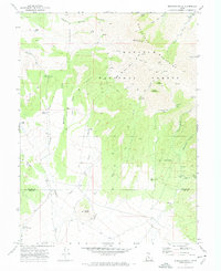
1971 · Erickson Knoll
USGS Topo · 1:24,000

1971 · Desert Mtn Pass
USGS Topo · 1:24,000