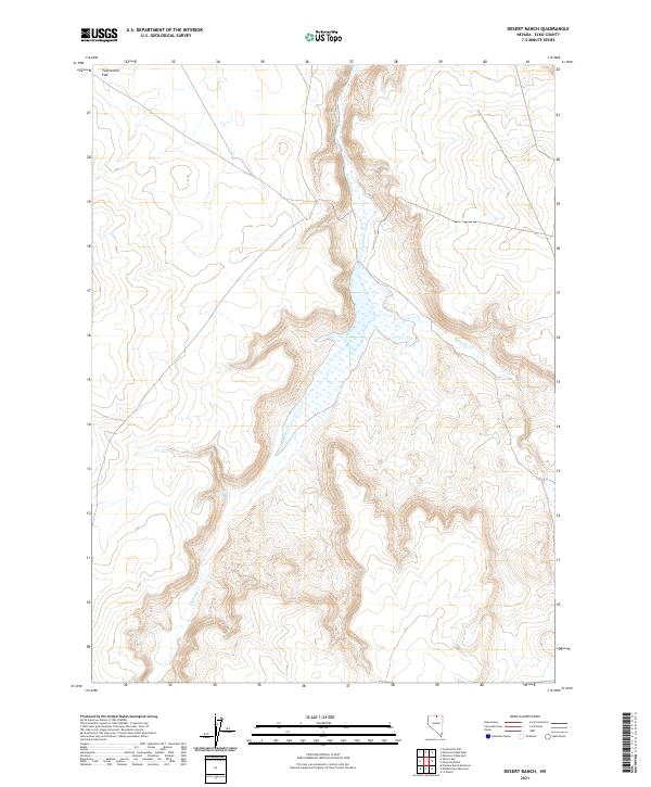
2021 Map of Desert Ranch
USGS Topo · Published 2021About this map
Chimney Creek and Fourmile Creek define the drainage patterns of this high-desert landscape in Elko County. The terrain is characterized by the broad expanse of Twelvemile Flat in the northwest, where the topography levels out before rising into the dissected plateaus and seasonal watercourses that mark the region. This 2021 update from the U.S. Geological Survey utilizes data from the National Hydrography Dataset and the National Elevation Dataset to trace the subtle shifts in elevation and the intermittent flow of desert streams. The map reveals a land primarily organized by the Public Land Survey System, showing township and range boundaries such as t44n r48e and t43n r49e, reflecting the enduring legal framework of the American West.
Find a feature on this map
9 named features on this map. Tap any name to fly to it.
Don’t see what you’re looking for? This feature index may not catch every label — zoom into the map to look around manually.
Map Details
Editions of this 2021 Desert Ranch Map
This is the sole edition of this map. No revisions or reprints were ever made.
Other maps of this area

1955 · McDermitt
USGS Topo · 1:250,000

1959 · McDermitt
USGS Topo · 1:250,000

1964 · Hat Peak
USGS Topo · 1:62,500

1964 · Wilson Reservoir
USGS Topo · 1:62,500

1973 · Twelvemile Flat
USGS Topo · 1:24,000
1974 · Twelvemile Flat SE
USGS Topo · 1:24,000

1974 · Middle Draw Reservoir
USGS Topo · 1:24,000

1974 · Winters Ranch Reservoir
USGS Topo · 1:24,000

1974 · Desert Ranch
USGS Topo · 1:24,000
1977 · Silver Lake
USGS Topo · 1:24,000