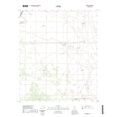
2023 Map of Desert SW
USGS Topo · Published 2023About this map
Fort Bliss dominates this arid landscape along the border of New Mexico and Texas, serving as a critical military installation in the Chihuahuan Desert. The terrain is characterized by broad basins and isolated landforms like Davis Dome, with the map detailing the infrastructure supporting operations in this expansive region. A network of tactical and access roads, including Mcgregor Range Rd and Carlsbad Rd, crisscross the area, connecting various facility points.
Find a feature on this map
22 named features on this map. Tap any name to fly to it.
Don’t see what you’re looking for? This feature index may not catch every label — zoom into the map to look around manually.
Map Details
Editions of this 2023 Desert SW Map
This is the sole edition of this map. No revisions or reprints were ever made.
Other maps of this area

1896 · El Paso
USGS Topo · 1:125,000

1908 · El Paso
USGS Topo · 1:125,000

1939 · Heuco Tanks
USGS Topo · 1:62,500

1940 · Heuco Tanks
USGS Topo · 1:62,500

1940 · Newman
USGS Topo · 1:62,500

1941 · Desert
USGS Topo · 1:62,500

1942 · Fort Bliss
USGS Topo · 1:62,500

1943 · Desert
USGS Topo · 1:62,500

1943 · Newman
USGS Topo · 1:62,500

1944 · Heuco Tanks
USGS Topo · 1:62,500