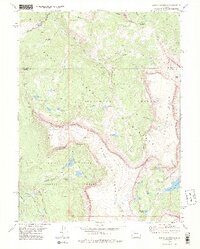
1977 Map of Devils Causeway
USGS Topo · Published 1988About this map
Chinese Wall and the dramatic basalt cliffs of the Flat Tops dominate this high-altitude landscape where the Routt National Forest meets the White River National Forest. The 1970s terrain is characterized by a high volcanic plateau carved into deep basins and gulches, most notably the narrow ridge of the Devils Causeway. This area is a significant hydrographic hub, showing the headwaters for several major drainages including the East Fork Williams Fork and the North Fork White River. Numerous subalpine lakes are clustered throughout the wilderness, such as Lost Lakes, Skinny Fish Lake, and Deep Lake. The map reveals a land almost entirely devoid of roads, instead defined by an intricate network of Pack Trails that connect remote points like Mandall Pass and the Stillwater Reservoir.
Find a feature on this map
41 named features on this map. Tap any name to fly to it.
Don’t see what you’re looking for? This feature index may not catch every label — zoom into the map to look around manually.
Map Details
Editions of this 1977 Devils Causeway Map
4 editions found
Other maps of this area

1927 · Glenwood Springs
USGS Topo · 1:125,000

1930 · Glenwood Springs
USGS Topo · 1:125,000

1954 · Craig
USGS Topo · 1:250,000

1957 · Craig
USGS Topo · 1:250,000

1957 · Leadville
USGS Topo · 1:250,000

1958 · Craig
USGS Topo · 1:250,000

1959 · Leadville
USGS Topo · 1:250,000

1960 · Leadville
USGS Topo · 1:250,000

1960 · Craig
USGS Topo · 1:250,000

1962 · Leadville
USGS Topo · 1:250,000