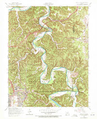
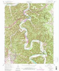
1954 Map of Devils Elbow
USGS Topo · Published 1972About this map
The Big Piney River winds through the heart of this mid-1950s survey, creating the dramatic bend that gives Devils Elbow its name. This period captures the coexistence of traditional Ozark settlements and the significant presence of the Fort Leonard Wood Military Reservation in the southwest corner. The landscape is dotted with rural institutions that define the local social fabric, from the Hooker School and Low Gap School to the Community Church and several small family burial grounds like Spaulding Cem and Hale Cem.
Find a feature on this map
42 named features on this map. Tap any name to fly to it.
Don’t see what you’re looking for? This feature index may not catch every label — zoom into the map to look around manually.
Map Details
Editions of this 1954 Devils Elbow Map
5 editions found
Other maps of this area

1912 · Rolla
USGS Topo · 1:62,500

1936 · Waynesville
USGS Topo · 1:48,000

1937 · Edgar Springs
USGS Topo · 1:48,000

1941 · Big Piney
USGS Topo · 1:62,500

1942 · Waynesville
USGS Topo · 1:62,500

1943 · Big Piney
USGS Topo · 1:62,500

1944 · Waynesville
USGS Topo · 1:62,500

1945 · Edgar Springs
USGS Topo · 1:62,500

1949 · Rolla
USGS Topo · 1:250,000

1950 · Newburg
USGS Topo · 1:24,000