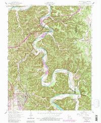
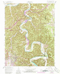
1954 Map of Devils Elbow
USGS Topo · Published 1985About this map
The Big Piney River meanders sharply through the Ozark landscape, defining the character of the Devils Elbow community. This mid-century survey captures a complex intersection of geography and infrastructure where the St Louis-San Francisco RR and U.S. 66 trace the high ground above the river's deep loops. Local life is anchored by rural institutions like the Hooker School, Calvary Church, and several family burial sites including Spaulding Cem and Rockwell Cem. The expansion of the Fort Leonard Wood Military Reservation dominates the southwest, while the Mark Twain National Forest blankets the eastern hills. Noteworthy rail sidings such as Hunt Siding and Lee Siding speak to the area's logistical importance, even as the newer alignment of Interstate 44 began to reshape the travel patterns of Pulaski County.
Find a feature on this map
38 named features on this map. Tap any name to fly to it.
Don’t see what you’re looking for? This feature index may not catch every label — zoom into the map to look around manually.
Map Details
Editions of this 1954 Devils Elbow Map
5 editions found
Other maps of this area

1912 · Rolla
USGS Topo · 1:62,500

1936 · Waynesville
USGS Topo · 1:48,000

1937 · Edgar Springs
USGS Topo · 1:48,000

1941 · Big Piney
USGS Topo · 1:62,500

1942 · Waynesville
USGS Topo · 1:62,500

1943 · Big Piney
USGS Topo · 1:62,500

1944 · Waynesville
USGS Topo · 1:62,500

1945 · Edgar Springs
USGS Topo · 1:62,500

1949 · Rolla
USGS Topo · 1:250,000

1950 · Newburg
USGS Topo · 1:24,000