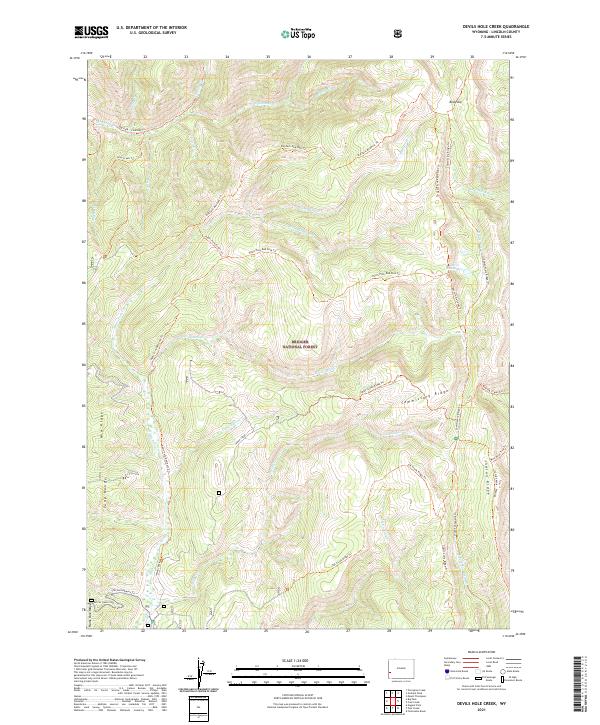
2021 Map of Devils Hole Creek
USGS Topo · Published 2021About this map
Bridger National Forest encompasses this high-altitude terrain in Wyoming's Lincoln County, where the hydrological divide of Commissary Ridge separates complex drainage systems. A dense network of pack trails, such as the Hams Fork-Red Park Trl and Indian Creek Ridge Trl, suggests a landscape managed for both timber and backcountry access. The headwaters of Devils Hole Cr lead into the Devils Hole Lakes, tucked beneath the eastern slopes of the ridge. To the west, the Tunp Range and Mid Ridge define the topography, with The Switchbacks Trl providing a dramatic ascent from the lower basins. The map captures the meeting of several townships, including t27n r117w and t27n r116w, highlighting a remote interior wilderness marked by family-named landmarks like Lost Horse Cr and the alpine meadows of Red Park.
Find a feature on this map
44 named features on this map. Tap any name to fly to it.
Don’t see what you’re looking for? This feature index may not catch every label — zoom into the map to look around manually.
Map Details
Editions of this 2021 Devils Hole Creek Map
This is the sole edition of this map. No revisions or reprints were ever made.
Other maps of this area

1936 · Cokeville
USGS Topo · 1:96,000

1942 · Cokeville
USGS Topo · 1:125,000

1955 · Preston
USGS Topo · 1:250,000

1958 · Preston
USGS Topo · 1:250,000

1962 · Preston
USGS Topo · 1:250,000
1967 · Pole Creek
USGS Topo · 1:24,000

1967 · Devils Hole Creek
USGS Topo · 1:24,000

1967 · Graham Peak
USGS Topo · 1:24,000

1967 · Big Park
USGS Topo · 1:24,000

1967 · Porcupine Creek
USGS Topo · 1:24,000