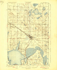
1931 Map of Devils Lake
USGS Topo · Published 1931About this map
Devils Lake serves as the central hub of this North Dakota prairie landscape, where the iron rails of the Great Northern and the Minneapolis St Paul and Sault Ste Marie converge. This 1928 survey captures a transition in the region's hydrology and land use, showing the expansive Dry Lake and Freshwater basins to the north and the intricate shorelines of Six Mile Bay and Mission bay to the south.
Find a feature on this map
42 named features on this map. Tap any name to fly to it.
Don’t see what you’re looking for? This feature index may not catch every label — zoom into the map to look around manually.
Map Details
Editions of this 1931 Devils Lake Map
3 editions found
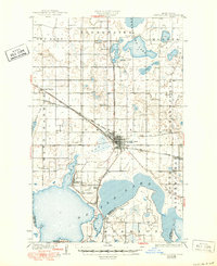
Other maps of this area

1928 · Tokio
USGS Topo · 1:62,500

1930 · Hamar
USGS Topo · 1:62,500

1931 · Oberon
USGS Topo · 1:62,500

1931 · Tokio
USGS Topo · 1:62,500

1931 · Devils Lake
USGS Topo · 1:62,500

1932 · Grahams Island
USGS Topo · 1:62,500

1950 · Tokio
USGS Topo · 1:24,000

1950 · Grahams Island
USGS Topo · 1:62,500

1950 · Devils Lake
USGS Topo · 1:62,500

1950 · Oberon
USGS Topo · 1:62,500