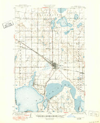
1931 Map of Devils Lake
USGS Topo · Published 1950About this map
The expanding city of Devils Lake serves as the central hub of this 1928 survey, which captures the region's complex transition from prairie to agricultural and military significance. The rail network of the Great Northern and the Minneapolis ST Paul And Sault Ste Marie intersects here, facilitating a connection between local farms and distant markets. Evidence of early twentieth-century rural education is prominent, with several locations noted as School No 1 and School No 2, including a Consolidated School No 1 reflecting the era's movement toward centralized schooling.
Find a feature on this map
28 named features on this map. Tap any name to fly to it.
Don’t see what you’re looking for? This feature index may not catch every label — zoom into the map to look around manually.
Map Details
Editions of this 1931 Devils Lake Map
3 editions found
Other maps of this area

1928 · Tokio
USGS Topo · 1:62,500

1930 · Hamar
USGS Topo · 1:62,500

1931 · Oberon
USGS Topo · 1:62,500

1931 · Tokio
USGS Topo · 1:62,500

1931 · Devils Lake
USGS Topo · 1:62,500

1932 · Grahams Island
USGS Topo · 1:62,500

1950 · Tokio
USGS Topo · 1:24,000

1950 · Grahams Island
USGS Topo · 1:62,500

1950 · Devils Lake
USGS Topo · 1:62,500

1950 · Oberon
USGS Topo · 1:62,500