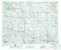
1953 Map of Devils Lake
USGS Topo · Published 1986About this map
Turtle Mountain rises above a landscape defined by glacial lakes and the expansive reach of the Great Northern and Burlington Northern railroads. This era of the North Dakota prairie shows a densely networked agricultural region where small settlements like Minnewaukan, Starkweather, and Rolla serve as vital hubs for the surrounding grain country. The map captures the complex hydrological system of the region, from the shores of Devils Lake and its multiple bays like Creel Bay and Mission Bay, to the protected wetlands of the Lake Alice National Wildlife Refuge. The footprint of the Fort Totten Indian Reservation and the Turtle Mountain Indian Reservation reflects the layered history of land use and administration. Local landmarks such as the Rose Hill School and Mt Carmel Dam provide specific points of interest for those tracing the social and structural development of these rural townships.
Find a feature on this map
151 named features on this map. Tap any name to fly to it.
Don’t see what you’re looking for? This feature index may not catch every label — zoom into the map to look around manually.
Map Details
Editions of this 1953 Devils Lake Map
3 editions found

Other maps of this area

1918 · Walhalla
USGS Topo · 1:62,500

1928 · Tokio
USGS Topo · 1:62,500

1930 · Pekin
USGS Topo · 1:62,500

1930 · Hamar
USGS Topo · 1:62,500

1931 · Oberon
USGS Topo · 1:62,500

1931 · Tokio
USGS Topo · 1:62,500

1931 · Devils Lake
USGS Topo · 1:62,500

1932 · Flora
USGS Topo · 1:62,500

1932 · Grahams Island
USGS Topo · 1:62,500

1935 · Dunseith
USGS Topo · 1:48,000