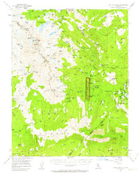
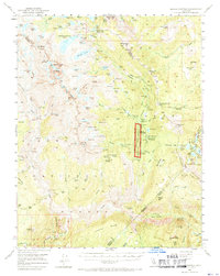
1953 Map of Devils Postpile
USGS Topo · Published 1963About this map
Devils Postpile National Monument centers this high-altitude landscape during the early 1950s, a period when the eastern Sierra began to see increased recreational development. The map details a complex network of alpine lakes and dramatic peaks like Mt Ritter and Banner Peak along the Ritter Range. Evidence of human activity and industry is scattered across the terrain, from the Minaret Mine tucked near Volcanic Ridge to the emerging winter sports hub at the Mammoth Mtn Ski Lodge. Notable for genealogists and local historians are the remote outposts like Bogg Cabin and the established camps at Agnew Meadows. The Middle Fork of the San Joaquin River serves as the primary drainage, passing landmarks such as Reds Meadow Hot Springs and Miller Crossing, illustrating the seasonal travel routes used by hikers and pack teams before modern road expansions dominated the region.
Find a feature on this map
156 named features on this map. Tap any name to fly to it.
Don’t see what you’re looking for? This feature index may not catch every label — zoom into the map to look around manually.
Map Details
Editions of this 1953 Devils Postpile Map
6 editions found

Other maps of this area

1901 · Mt. Lyell
USGS Topo · 1:125,000

1904 · Kaiser
USGS Topo · 1:125,000

1912 · Mt. Goddard
USGS Topo · 1:125,000

1914 · Mt. Morrison
USGS Topo · 1:125,000

1947 · Mariposa
USGS Topo · 1:250,000

1948 · Mariposa
USGS Topo · 1:250,000

1953 · Mt. Morrison
USGS Topo · 1:62,500

1953 · Merced Peak
USGS Topo · 1:62,500

1953 · Mt Abbot
USGS Topo · 1:62,500

1953 · Mono Craters
USGS Topo · 1:62,500