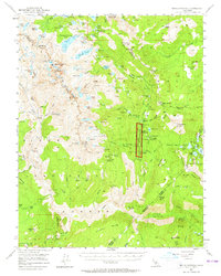
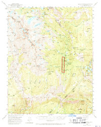
1953 Map of Devils Postpile
USGS Topo · Published 1965About this map
Devils Postpile National Monument serves as the central landmark in this high-altitude landscape where the Sierra National Forest meets the Inyo National Forest. The map details a complex system of alpine hydrology, from the large expanse of Thousand Island Lake and Garnet Lake to smaller basins like Minaret Lake and Lake Catherine. The terrain is dominated by the sharp elevations of Banner Peak, Mt Ritter, and the Minarets, illustrating the dramatic verticality of the Sierra Nevada crest.
Find a feature on this map
135 named features on this map. Tap any name to fly to it.
Don’t see what you’re looking for? This feature index may not catch every label — zoom into the map to look around manually.
Map Details
Editions of this 1953 Devils Postpile Map
6 editions found

Other maps of this area

1901 · Mt. Lyell
USGS Topo · 1:125,000

1904 · Kaiser
USGS Topo · 1:125,000

1912 · Mt. Goddard
USGS Topo · 1:125,000

1914 · Mt. Morrison
USGS Topo · 1:125,000

1947 · Mariposa
USGS Topo · 1:250,000

1948 · Mariposa
USGS Topo · 1:250,000

1953 · Mt. Morrison
USGS Topo · 1:62,500

1953 · Merced Peak
USGS Topo · 1:62,500

1953 · Mt Abbot
USGS Topo · 1:62,500

1953 · Mono Craters
USGS Topo · 1:62,500