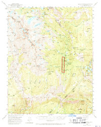
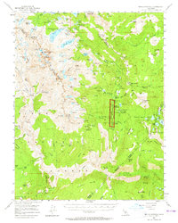
1953 Map of Devils Postpile
USGS Topo · Published 1970About this map
Devils Postpile National Monument serves as the focal point of this mid-century survey, capturing the High Sierra landscape during a period of expanding recreational use. The map details the complex topography of the Sierra National Forest, documenting the high-altitude terrain where the Muir Trail traverses granite peaks and alpine basins. Notable elevations include Mt Ritter, Banner Peak, and the jagged spires of The Minarets, which dominate the western portion of the quadrangle.
Find a feature on this map
142 named features on this map. Tap any name to fly to it.
Don’t see what you’re looking for? This feature index may not catch every label — zoom into the map to look around manually.
Map Details
Editions of this 1953 Devils Postpile Map
6 editions found

Other maps of this area

1901 · Mt. Lyell
USGS Topo · 1:125,000

1904 · Kaiser
USGS Topo · 1:125,000

1912 · Mt. Goddard
USGS Topo · 1:125,000

1914 · Mt. Morrison
USGS Topo · 1:125,000

1947 · Mariposa
USGS Topo · 1:250,000

1948 · Mariposa
USGS Topo · 1:250,000

1953 · Mt. Morrison
USGS Topo · 1:62,500

1953 · Merced Peak
USGS Topo · 1:62,500

1953 · Mt Abbot
USGS Topo · 1:62,500

1953 · Mono Craters
USGS Topo · 1:62,500