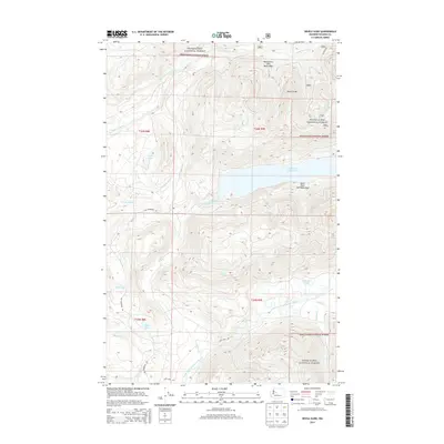
2014 Map of Devils Slide
USGS Topo · Published 2014About this map
Snoqualmie National Forest dominates this landscape in eastern King County, where the topography is defined by the protected headwaters of regional river systems. The map highlights the critical importance of water management in the Cascades, featuring the North Fork Tolt and South Fork Tolt Watershed alongside the S Fork Tolt Reservoir. The steep relief is anchored by the prominent Devils Slide landform, which overlooks a network of high-elevation water bodies including Lake Titicaed and Lynch Lake. Forest roads such as Tolt Reservoir Rd and Fury Lake Rd provide the primary access through these timberlands. Further south, the terrain descends toward the North Fork Snoqualmie River, passing by the secluded Black Lake and Fitchener Slough, illustrating the transition from alpine reservoirs to lower river drainage basins.
Find a feature on this map
27 named features on this map. Tap any name to fly to it.
Don’t see what you’re looking for? This feature index may not catch every label — zoom into the map to look around manually.
Map Details
Editions of this 2014 Devils Slide Map
This is the sole edition of this map. No revisions or reprints were ever made.
Other maps of this area

1921 · Sultan
USGS Topo · 1:125,000

1923 · Sultan
USGS Topo · 1:125,000

1953 · Snoqualmie
USGS Topo · 1:24,000

1953 · Sultan
USGS Topo · 1:24,000

1953 · Lake Joy
USGS Topo · 1:24,000

1956 · Monroe
USGS Topo · 1:62,500

1957 · Index
USGS Topo · 1:62,500

1957 · Wenatchee
USGS Topo · 1:250,000

1960 · Mount Si
USGS Topo · 1:62,500
1975 · Skykomish River
USGS Topo · 1:100,000