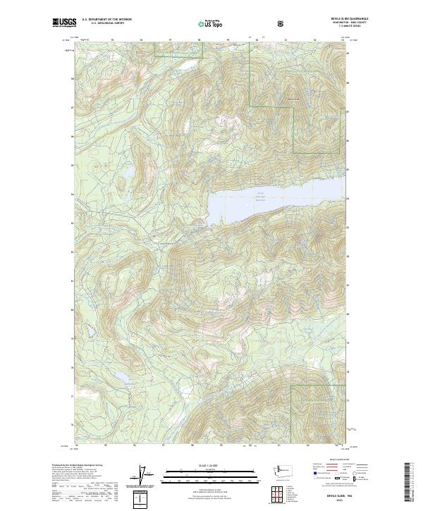
2023 Map of Devils Slide
USGS Topo · Published 2023About this map
Snoqualmie National Forest and the Alpine Lakes Wilderness encompass this heavily forested region of the Cascade Range, dominated by a complex network of glacial lakes and steep drainage basins. The South Fork Tolt Reservoir serves as a central landmark, collecting waters from the South Fork Tolt River and nearby high-altitude basins like Lynch Lake and Lake Titicaca. This environment is shaped by the dramatic topography of Devils Slide, where the landscape drops sharply toward the river valleys below.
Find a feature on this map
32 named features on this map. Tap any name to fly to it.
Don’t see what you’re looking for? This feature index may not catch every label — zoom into the map to look around manually.
Map Details
Editions of this 2023 Devils Slide Map
This is the sole edition of this map. No revisions or reprints were ever made.
Other maps of this area

1921 · Sultan
USGS Topo · 1:125,000

1923 · Sultan
USGS Topo · 1:125,000

1953 · Snoqualmie
USGS Topo · 1:24,000

1953 · Sultan
USGS Topo · 1:24,000

1953 · Lake Joy
USGS Topo · 1:24,000

1956 · Monroe
USGS Topo · 1:62,500

1957 · Index
USGS Topo · 1:62,500

1957 · Wenatchee
USGS Topo · 1:250,000

1960 · Mount Si
USGS Topo · 1:62,500
1975 · Skykomish River
USGS Topo · 1:100,000