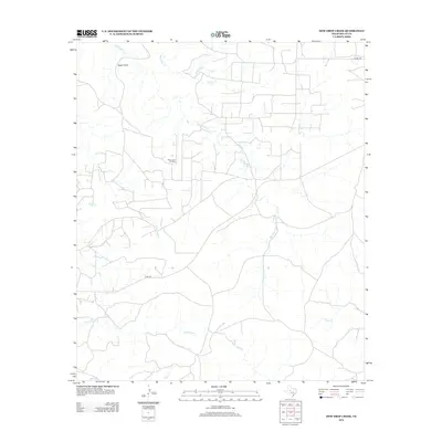
2012 Map of Dew Drop Creek
USGS Topo · Published 2012About this map
The Nena Lucia Oil Field defines the industrial footprint of this West Texas landscape, where the petroleum economy overlays a network of seasonal watercourses. The drainage system is characterized by the branching paths of Dew Drop Cr and Big Silver Cr, which cut through the arid terrain of Nolan County. Landmarks like Eagle Point and Silver Lake provide essential geographic orientation in a region largely defined by its wide-reaching ranch roads and energy production sites. Sparse but significant features such as Deadman Spring indicate the critical importance of water sources in this environment, while local routes like Co RD 273 connect the scattered infrastructure. The map reveals the intricate intersection of natural hydrology, including Cottonwood Cr and Yellow Wolf Cr, with the man-made developments required for resource extraction.
Find a feature on this map
14 named features on this map. Tap any name to fly to it.
Don’t see what you’re looking for? This feature index may not catch every label — zoom into the map to look around manually.
Map Details
Editions of this 2012 Dew Drop Creek Map
This is the sole edition of this map. No revisions or reprints were ever made.
Other maps of this area

1893 · Sweetwater
USGS Topo · 1:125,000

1954 · Big Spring
USGS Topo · 1:250,000

1958 · Big Spring
USGS Topo · 1:250,000

1959 · Dam Draw
USGS Topo · 1:24,000

1959 · Silver
USGS Topo · 1:24,000

1962 · Sanco
USGS Topo · 1:24,000

1969 · Baumann School
USGS Topo · 1:24,000

1969 · Bench Mountain
USGS Topo · 1:24,000

1969 · Maryneal
USGS Topo · 1:24,000
1969 · Dew Drop Creek
USGS Topo · 1:24,000