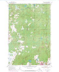
1955 Map of Dewey Lake SE
USGS Topo · Published 1971About this map
Laurentian Divide marks the geological spine of this Iron Range landscape, where the geography of industrial extraction meets the dense woods of the Superior National Forest. This 1955 survey, with 1969 revisions, documents a critical corridor of Minnesota’s mining history. The southern portion of the map is dominated by the complex operations of the Mesabi Range, featuring the Wabigon Mine, Margaret Mine, and Grant Mine, along with numerous Mine Dumps and a Tailings Pond. These industrial sites sit in close proximity to the residential hubs of Buhl and Kinney, illustrating the tight spatial relationship between the mining workforce and the pits they worked. North of the divide, the terrain transitions into a more hydrologically complex wilderness defined by the East Branch Sturgeon River and scattered water bodies like Deepwater Lake and McNiven Lake.
Find a feature on this map
33 named features on this map. Tap any name to fly to it.
Don’t see what you’re looking for? This feature index may not catch every label — zoom into the map to look around manually.
Map Details
Editions of this 1955 Dewey Lake SE Map
4 editions found
Other maps of this area

1951 · Kinney
USGS Topo · 1:24,000

1951 · Kirk
USGS Topo · 1:24,000

1951 · Hibbing
USGS Topo · 1:24,000

1951 · Buhl
USGS Topo · 1:24,000

1952 · Idington
USGS Topo · 1:24,000

1954 · Hibbing
USGS Topo · 1:250,000

1955 · Dark Lake
USGS Topo · 1:24,000

1955 · Dewey Lake SE
USGS Topo · 1:24,000

1955 · Dewey Lake NW
USGS Topo · 1:24,000

1955 · Dewey Lake
USGS Topo · 1:24,000