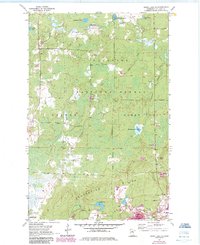
1955 Map of Dewey Lake SE
USGS Topo · Published 1985About this map
The Laurentian Divide marks a significant hydrologic boundary across this portion of St. Louis County, where industrial activity and dense wetlands coexist. In the southern half, the landscape is defined by the heavy iron mining operations concentrated around Buhl, Kinney, and the edge of Chisholm. Excavations and processing sites like the Wabigon Mine, Sheras Mine, and Grant Mine dominate the area, alongside extensive Mine Dumps and a large Tailings Pond.
Find a feature on this map
28 named features on this map. Tap any name to fly to it.
Don’t see what you’re looking for? This feature index may not catch every label — zoom into the map to look around manually.
Map Details
Editions of this 1955 Dewey Lake SE Map
4 editions found
Other maps of this area

1951 · Kinney
USGS Topo · 1:24,000

1951 · Kirk
USGS Topo · 1:24,000

1951 · Hibbing
USGS Topo · 1:24,000

1951 · Buhl
USGS Topo · 1:24,000

1952 · Idington
USGS Topo · 1:24,000

1954 · Hibbing
USGS Topo · 1:250,000

1955 · Dark Lake
USGS Topo · 1:24,000

1955 · Dewey Lake SE
USGS Topo · 1:24,000

1955 · Dewey Lake NW
USGS Topo · 1:24,000

1955 · Dewey Lake
USGS Topo · 1:24,000