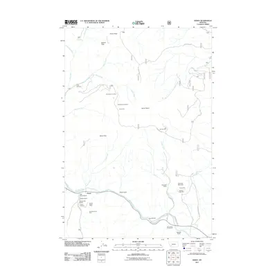
2011 Map of Dewey
USGS Topo · Published 2011About this map
The Big Hole River carves through this corner of Silver Bow County, anchoring a landscape defined by its mining heritage and rugged terrain. Near the settlement of Dewey, the terrain is marked by numerous historic workings, including the Big Hole Copper Mine and the Cayuga Mine. These sites, along with others like the Old Tom Horn Mine and Grafton Mine, reflect a period of intensive resource extraction in the mountains surrounding Mount Fleecer.
Find a feature on this map
40 named features on this map. Tap any name to fly to it.
Don’t see what you’re looking for? This feature index may not catch every label — zoom into the map to look around manually.
Map Details
Editions of this 2011 Dewey Map
This is the sole edition of this map. No revisions or reprints were ever made.
Other maps of this area

1893 · Dillon
USGS Topo · 1:250,000

1955 · Dillon
USGS Topo · 1:250,000

1957 · Dillon
USGS Topo · 1:250,000

1958 · Dillon
USGS Topo · 1:250,000

1958 · Vipond Park
USGS Topo · 1:62,500

1961 · Melrose
USGS Topo · 1:24,000
1961 · Burnt Mountain
USGS Topo · 1:24,000
1961 · Dickie Peak
USGS Topo · 1:24,000

1961 · Butte South
USGS Topo · 1:62,500

1961 · Dewey
USGS Topo · 1:24,000