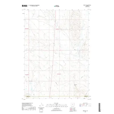
2017 Map of Dewey SW
USGS Topo · Published 2017About this map
The high plains of the Weston Co and Niobrara Co border are defined by a complex network of intermittent drainages and ranch roads. Water management is central to this arid landscape, anchored by the Fillinger Reservoir in the southwestern quadrant. The terrain is marked by distinct topographical features like Rattlesnake Ridge, which overlooks the eastern drainages. These natural corridors, including Stockade Beaver Cr and Beaver Cr, have historically dictated the placement of travel routes through the region. Transportation follows the contours of the land, with Morrsey Rd, Cheyenne River Rd, and Old Hwy 85 providing access across the township lines. The map reveals the quiet persistence of rural infrastructure, where named creeks like Robbers Roost Cr and Lone Tree Cr serve as vital landmarks for navigation and land division.
Find a feature on this map
18 named features on this map. Tap any name to fly to it.
Don’t see what you’re looking for? This feature index may not catch every label — zoom into the map to look around manually.
Map Details
Editions of this 2017 Dewey SW Map
This is the sole edition of this map. No revisions or reprints were ever made.
Other maps of this area

1899 · Newcastle
USGS Topo · 1:125,000

1901 · Newcastle
USGS Topo · 1:125,000

1951 · Owens
USGS Topo · 1:24,000

1951 · Dewey
USGS Topo · 1:24,000

1951 · Dewey SW
USGS Topo · 1:24,000

1951 · Twentyone Divide
USGS Topo · 1:24,000

1951 · Morrisey NE
USGS Topo · 1:24,000

1951 · Clifton
USGS Topo · 1:24,000

1955 · Newcastle
USGS Topo · 1:250,000

1958 · Newcastle
USGS Topo · 1:250,000