
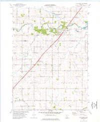
1965 Map of Dexter
USGS Topo · Published 1966About this map
The intersection of significant Midwest rail lines and early modern highway development defines this portion of Mower County during the mid-1960s. Dexter sits at a critical junction where the Chicago Milwaukee St Paul and Pacific railroad crosses the north-south route of the Chicago Great Western. The introduction of Interstate 90 cuts diagonally across the landscape, signaling a shift in transportation priority from the rails to the road. To the south, the village of Elkton remains anchored by its water tank and proximity to the Great Western line.
Find a feature on this map
22 named features on this map. Tap any name to fly to it.
Don’t see what you’re looking for? This feature index may not catch every label — zoom into the map to look around manually.
Map Details
Editions of this 1965 Dexter Map
This is the sole edition of this map. No revisions or reprints were ever made.
Other maps of this area

1954 · Austin
USGS Topo · 1:62,500

1954 · Mason City
USGS Topo · 1:250,000

1955 · High Forest
USGS Topo · 1:62,500

1957 · Mason City
USGS Topo · 1:250,000

1958 · Mason City
USGS Topo · 1:250,000

1965 · Le Roy
USGS Topo · 1:24,000

1965 · Grand Meadow
USGS Topo · 1:24,000

1965 · Adams
USGS Topo · 1:24,000

1966 · Sargeant
USGS Topo · 1:24,000
1974 · High Forest
USGS Topo · 1:24,000