
1966 Map of Sargeant
USGS Topo · Published 1967About this map
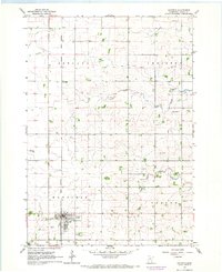
Sargeant and Waltham anchor this mid-1960s agricultural landscape on the border of Dodge and Mower counties. The geography is defined by a series of north-south drainage patterns, including the Cedar River, Roberts Creek, and the North Branch Root River, which carve subtle valleys into the surrounding farmland. The infrastructure of the era is prominently displayed through the Chicago Great Western railroad, which bisects the townships and connects these small shipping points to the broader regional economy. Local life and civic history are recorded in the placement of the Townhall in Waltham township, St Johns Ch, and the Waltham Cem. An interesting operational detail is the inclusion of several small aviation facilities, such as the Landing Strip north of Sargeant, reflecting the utility of private flight in rural Minnesota at this time.
Find a feature on this map
20 named features on this map. Tap any name to fly to it.
Don’t see what you’re looking for? This feature index may not catch every label — zoom into the map to look around manually.
Map Details
Editions of this 1966 Sargeant Map
This is the sole edition of this map. No revisions or reprints were ever made.
Other maps of this area

1954 · Austin
USGS Topo · 1:62,500

1954 · Mason City
USGS Topo · 1:250,000

1955 · High Forest
USGS Topo · 1:62,500

1957 · Mason City
USGS Topo · 1:250,000

1958 · Mason City
USGS Topo · 1:250,000

1965 · Dexter
USGS Topo · 1:24,000

1966 · Waltham
USGS Topo · 1:24,000

1966 · Hayfield NW
USGS Topo · 1:24,000
1966 · Hayfield
USGS Topo · 1:24,000
1974 · Rock Dell
USGS Topo · 1:24,000