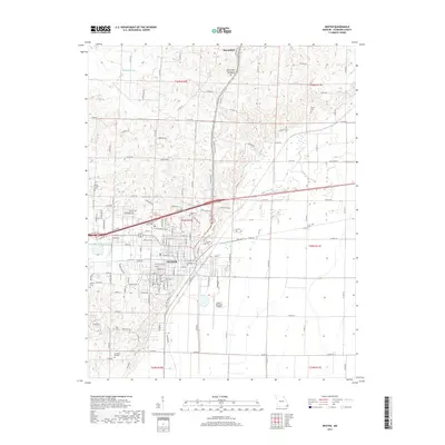
2017 Map of Dexter
USGS Topo · Published 2017About this map
The city of Dexter serves as the central hub of this Stoddard County landscape, situated where the rolling hills of the north meet the flat agricultural plains of the south. This transition is marked by the course of the Dudley Main Ditch, a significant water management feature that reflects the region's history of reclaiming lowland for cultivation. To the north, the terrain is more varied, hosting the town of Bloomfield and the Missouri State Veterans Cem - Bloomfield.
Find a feature on this map
123 named features on this map. Tap any name to fly to it.
Don’t see what you’re looking for? This feature index may not catch every label — zoom into the map to look around manually.
Map Details
Editions of this 2017 Dexter Map
This is the sole edition of this map. No revisions or reprints were ever made.
Other maps of this area

1934 · Bloomfield
USGS Topo · 1:62,500

1934 · Puxico
USGS Topo · 1:62,500

1939 · Bloomfield
USGS Topo · 1:62,500

1939 · Puxico
USGS Topo · 1:62,500

1940 · Malden
USGS Topo · 1:62,500

1940 · Valley Ridge
USGS Topo · 1:62,500

1949 · Bloomfield
USGS Topo · 1:62,500

1956 · Valley Ridge
USGS Topo · 1:62,500

1956 · Malden
USGS Topo · 1:62,500

1956 · Dyersburg
USGS Topo · 1:250,000