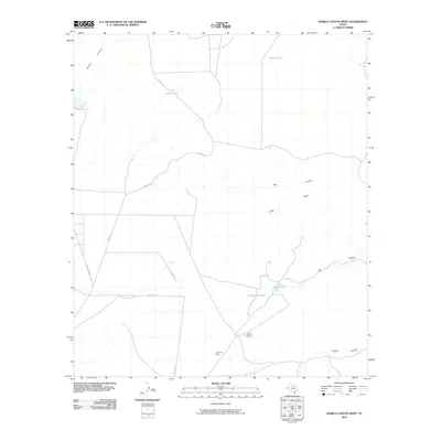
2010 Map of Diablo Canyon West
USGS Topo · Published 2010About this map
Wilkey Ranch anchors this arid Hudspeth County landscape, reflecting the remote cattle ranching traditions of West Texas. The region is defined by essential water infrastructure, including Milner Lake and several man-made reservoirs like Curtiss Tank, Camp Rice Tank, and Prince Albert Tank, which sustain life in an environment carved by Alamo Canyon and Diablo Canyon.
Find a feature on this map
15 named features on this map. Tap any name to fly to it.
Don’t see what you’re looking for? This feature index may not catch every label — zoom into the map to look around manually.
Map Details
Editions of this 2010 Diablo Canyon West Map
This is the sole edition of this map. No revisions or reprints were ever made.
Other maps of this area

1894 · Fort Hancock
USGS Topo · 1:125,000

1903 · Cerro Alto
USGS Topo · 1:125,000

1942 · Borrego
USGS Topo · 1:62,500

1943 · Tepee Butte
USGS Topo · 1:62,500

1943 · Finlay Mountains
USGS Topo · 1:62,500

1943 · Fort Hancock
USGS Topo · 1:62,500

1954 · Van Horn
USGS Topo · 1:250,000

1958 · Van Horn
USGS Topo · 1:250,000
1972 · Campo Grande Mountain
USGS Topo · 1:24,000
1972 · Small
USGS Topo · 1:24,000