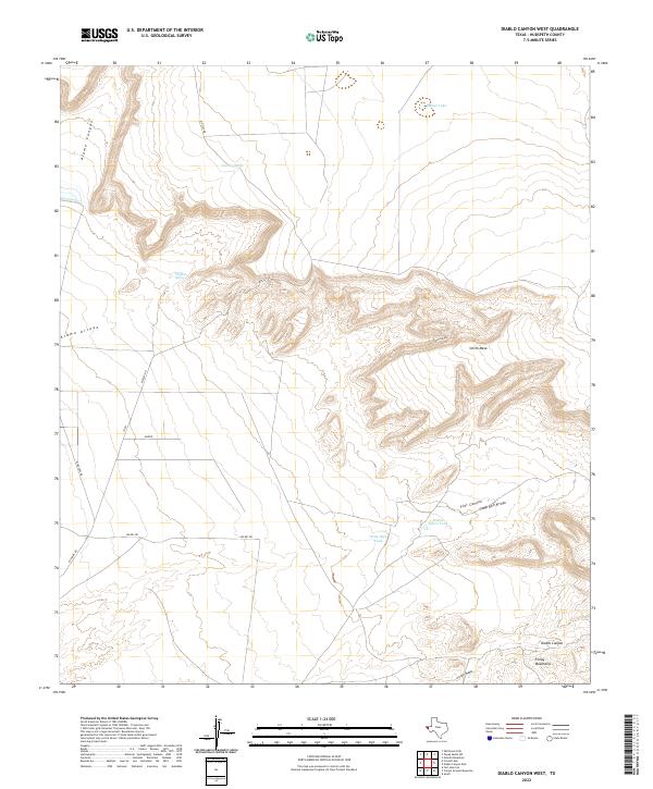
2022 Map of Diablo Canyon West
USGS Topo · Published 2022About this map
Smith Mesa dominates the central landscape of this West Texas terrain, where the northern reaches of the Finlay Mountains meet a complex network of canyons and dry watercourses. The area is defined by its hydraulic management, visible through a series of namesake reservoirs such as Prince Albert Tank, Camp Rice Tank, and Curtiss Tank, which support the high-desert environment. Essential water sources like Thaxton Spring further anchor the geography of this remote portion of Hudspeth County. A sparse network of local tracks, including Mosley Rd and Wilkey Rd, provides the only access across the deep incisions of Alamo Canyon and Diablo Canyon. These features illustrate the intersection of natural drainage patterns, such as Camp Rice Arroyo, and the necessary infrastructure for ranching or land management in a semi-arid climate.
Find a feature on this map
20 named features on this map. Tap any name to fly to it.
Don’t see what you’re looking for? This feature index may not catch every label — zoom into the map to look around manually.
Map Details
Editions of this 2022 Diablo Canyon West Map
This is the sole edition of this map. No revisions or reprints were ever made.
Other maps of this area

1894 · Fort Hancock
USGS Topo · 1:125,000

1903 · Cerro Alto
USGS Topo · 1:125,000

1942 · Borrego
USGS Topo · 1:62,500

1943 · Tepee Butte
USGS Topo · 1:62,500

1943 · Finlay Mountains
USGS Topo · 1:62,500

1943 · Fort Hancock
USGS Topo · 1:62,500

1954 · Van Horn
USGS Topo · 1:250,000

1958 · Van Horn
USGS Topo · 1:250,000
1972 · Campo Grande Mountain
USGS Topo · 1:24,000
1972 · Small
USGS Topo · 1:24,000