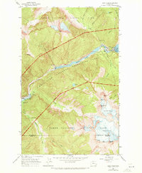
1963 Map of Diablo Dam
USGS Topo · Published 1972About this map
Diablo Dam and the Skagit River hydroelectric infrastructure anchor this mid-century survey of the high mountain landscape. The map details the complex industrial presence of the Seattle City Light settlements at Newhalem and Diablo, including the Gorge Powerhouse, Substation, and Intake Tower. These remote company towns are surrounded by the designated wilderness of North Cascades National Park and the Ross Lake National Recreation Area, where massive ice fields like the Neve Glacier and Colonial Glacier dominate the high peaks. The topography illustrates the dramatic elevation changes between the reservoir surfaces of Gorge Lake and Diablo Lake and the soaring summits of Snowfield Peak and Pyramid Peak. Established routes for fire watch and recreation are visible, including the Sourdough Lookout Trail, while the Whatcom Co Skagit Co line cuts through the southern glaciers.
Find a feature on this map
44 named features on this map. Tap any name to fly to it.
Don’t see what you’re looking for? This feature index may not catch every label — zoom into the map to look around manually.
Map Details
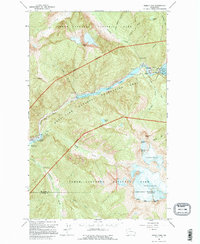
Editions of this 1963 Diablo Dam Map
3 editions found
Other maps of this area

1953 · Marblemount
USGS Topo · 1:62,500

1953 · Mt Challenger
USGS Topo · 1:62,500

1955 · Concrete
USGS Topo · 1:250,000

1958 · Concrete
USGS Topo · 1:250,000

1962 · Concrete
USGS Topo · 1:250,000

1963 · Eldorado Peak
USGS Topo · 1:24,000
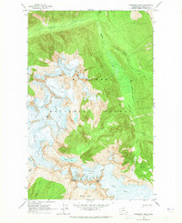
1963 · Forbidden Peak
USGS Topo · 1:24,000

1963 · Diablo Dam
USGS Topo · 1:24,000

1963 · Ross Dam
USGS Topo · 1:24,000

1969 · Mt Prophet
USGS Topo · 1:24,000