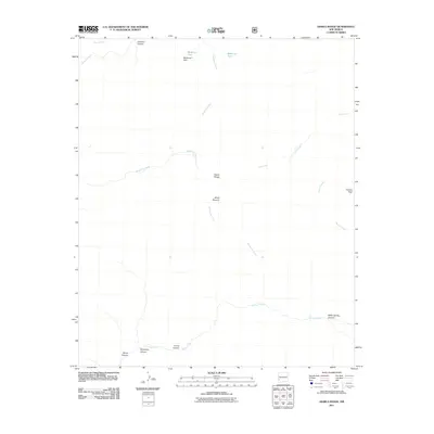
2011 Map of Diablo Range
USGS Topo · Published 2011About this map
Diablo Range defines the high-altitude landscape of this 2011 survey in Grant County, where the terrain is marked by a complex network of canyons and peaks. Notable landmarks like White Pinnacle and Granite Peak stand above the drainage basins of Mogollon Creek and Turkey Creek. The map documents a rugged wilderness area where water sources such as McKenna Tank and the seasonal flows of Rawmeat Creek were critical for local navigation and livestock.
Find a feature on this map
18 named features on this map. Tap any name to fly to it.
Don’t see what you’re looking for? This feature index may not catch every label — zoom into the map to look around manually.
Map Details
Editions of this 2011 Diablo Range Map
This is the sole edition of this map. No revisions or reprints were ever made.
Other maps of this area

1910 · Mogollon
USGS Topo · 1:125,000

1911 · Alum Mountain
USGS Topo · 1:125,000

1912 · Mogollon
USGS Topo · 1:125,000

1913 · Alum Mountain
USGS Topo · 1:125,000

1954 · Clifton
USGS Topo · 1:250,000

1957 · Clifton
USGS Topo · 1:250,000

1958 · Clifton
USGS Topo · 1:250,000

1962 · Clifton
USGS Topo · 1:250,000
1965 · Canteen Canyon
USGS Topo · 1:24,000
1965 · Diablo Range
USGS Topo · 1:24,000