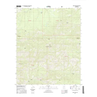
2017 Map of Diablo Range
USGS Topo · Published 2017About this map
The Diablo Range forms a prominent ridgeline across this section of the Gila National Forest, marking the boundary between Catron and Grant counties. This high-altitude landscape within the Mogollon Mountains is defined by a dense network of canyons and peaks, including the sharp rise of White Pinnacle and the elevation of Granite Peak. For those studying the geography of southwestern New Mexico, the map details numerous vital water sources such as McKenna Spring, Horse Spring, and Turbo Spring, which supported livestock and wildlife in this arid environment.
Find a feature on this map
32 named features on this map. Tap any name to fly to it.
Don’t see what you’re looking for? This feature index may not catch every label — zoom into the map to look around manually.
Map Details
Editions of this 2017 Diablo Range Map
This is the sole edition of this map. No revisions or reprints were ever made.
Other maps of this area

1910 · Mogollon
USGS Topo · 1:125,000

1911 · Alum Mountain
USGS Topo · 1:125,000

1912 · Mogollon
USGS Topo · 1:125,000

1913 · Alum Mountain
USGS Topo · 1:125,000

1954 · Clifton
USGS Topo · 1:250,000

1957 · Clifton
USGS Topo · 1:250,000

1958 · Clifton
USGS Topo · 1:250,000

1962 · Clifton
USGS Topo · 1:250,000
1965 · Canteen Canyon
USGS Topo · 1:24,000
1965 · Diablo Range
USGS Topo · 1:24,000