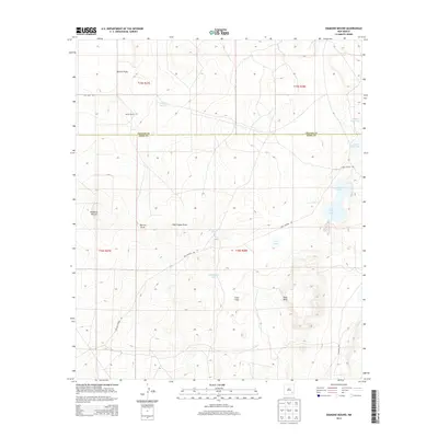
2013 Map of Diamond Mound
USGS Topo · Published 2013About this map
The Chaves County and Eddy County line divides this high plains landscape, where subtle elevation changes define a series of intermittent lakes and seasonal drainages. Scattered across the terrain are numerous isolated basins such as White Lake, Nakee Ishee Lake, and Henderson Lake, which characterize the internal drainage patterns of this arid region. The topography is shaped by the winding paths of Derrick Draw and Dog Canyon Draw, which cut through the landscape toward more prominent features like Pavo Mesa. Human presence in this section of New Mexico is sparse, marked by the long-established Merritt Ranch and a network of secondary routes including Rat Camp Rd and Dog Canyon Rd. The eponymous Diamond Mound stands as a distinct local landmark in the western portion of the survey area, providing a rare point of vertical relief in the surrounding Crow Flats.
Find a feature on this map
21 named features on this map. Tap any name to fly to it.
Don’t see what you’re looking for? This feature index may not catch every label — zoom into the map to look around manually.
Map Details
Editions of this 2013 Diamond Mound Map
This is the sole edition of this map. No revisions or reprints were ever made.
Other maps of this area

1951 · Ninemile Well
USGS Topo · 1:24,000

1951 · King Camp
USGS Topo · 1:24,000

1951 · Diamond Mound
USGS Topo · 1:24,000

1951 · Hagerman
USGS Topo · 1:24,000

1953 · Basin Well
USGS Topo · 1:24,000

1954 · Carlsbad
USGS Topo · 1:250,000

1955 · Artesia NE
USGS Topo · 1:24,000

1955 · Spring Lake
USGS Topo · 1:24,000

1955 · Red Lake SE
USGS Topo · 1:24,000

1955 · Roswell
USGS Topo · 1:250,000