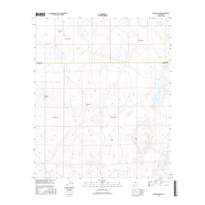
2017 Map of Diamond Mound
USGS Topo · Published 2017About this map
Diamond Mound rises above a landscape defined by ephemeral drainage patterns and seasonal basins along the border of Chaves and Eddy Counties. This 2017 survey details the hydrologic character of the region, where internal drainage leads to several named playas and sinks including White Lake, Crow Flat Lake, Cave Lake, and Flat Lake. These features, along with Ashee Lake in the northeast, represent the intermittent water sources critical to the arid high plains environment.
Find a feature on this map
17 named features on this map. Tap any name to fly to it.
Don’t see what you’re looking for? This feature index may not catch every label — zoom into the map to look around manually.
Map Details
Editions of this 2017 Diamond Mound Map
This is the sole edition of this map. No revisions or reprints were ever made.
Other maps of this area

1951 · Ninemile Well
USGS Topo · 1:24,000

1951 · King Camp
USGS Topo · 1:24,000

1951 · Diamond Mound
USGS Topo · 1:24,000

1951 · Hagerman
USGS Topo · 1:24,000

1953 · Basin Well
USGS Topo · 1:24,000

1954 · Carlsbad
USGS Topo · 1:250,000

1955 · Artesia NE
USGS Topo · 1:24,000

1955 · Spring Lake
USGS Topo · 1:24,000

1955 · Red Lake SE
USGS Topo · 1:24,000

1955 · Roswell
USGS Topo · 1:250,000