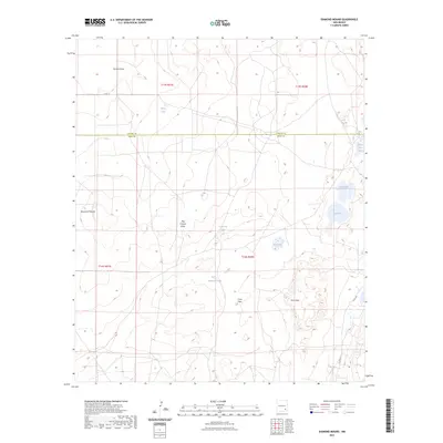
2023 Map of Diamond Mound
USGS Topo · Published 2023About this map
Diamond Mound rises above the basin floor in this high-desert region of New Mexico, where the boundary between Chaves and Eddy counties bisects a landscape defined by ephemeral hydrology. The topography is marked by a sequence of playas and seasonal basins, including the clustered waters of White Lake, Henderson Lake, and Crow Flat Lake. This area of the Pecos Valley watershed shows a pattern of drainage through features like Derrick Draw and Dog Canyon Draw, which channel intermittent flows across the wide plains of Crow Flats. The eastern edge of the quadrangle reveals a concentration of larger basins such as Jahie Lake and Flat Lake, situated near the elevated terrain of Pavo Mesa. Human activity is primarily represented by the established grid of the Public Land Survey System and local transit corridors like County Road 35.
Find a feature on this map
19 named features on this map. Tap any name to fly to it.
Don’t see what you’re looking for? This feature index may not catch every label — zoom into the map to look around manually.
Map Details
Editions of this 2023 Diamond Mound Map
This is the sole edition of this map. No revisions or reprints were ever made.
Other maps of this area

1951 · Ninemile Well
USGS Topo · 1:24,000

1951 · King Camp
USGS Topo · 1:24,000

1951 · Diamond Mound
USGS Topo · 1:24,000

1951 · Hagerman
USGS Topo · 1:24,000

1953 · Basin Well
USGS Topo · 1:24,000

1954 · Carlsbad
USGS Topo · 1:250,000

1955 · Artesia NE
USGS Topo · 1:24,000

1955 · Spring Lake
USGS Topo · 1:24,000

1955 · Red Lake SE
USGS Topo · 1:24,000

1955 · Roswell
USGS Topo · 1:250,000