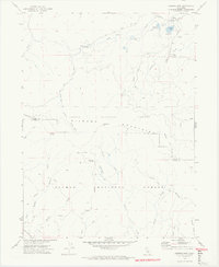
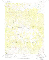
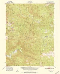
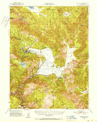
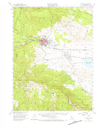
1972 Map of Diamond Mtn
USGS Topo · Published 1974About this map
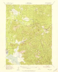
The Diamond Mountains define this high-altitude landscape on the border of Lassen and Plumas counties, where water resources and early homesteading history intersect. In the northeast corner, the Peter Lassen Grave serves as a significant pioneer landmark, situated near Emerson Lake and the Richmond Sch. The area is marked by a complex system of springs and reservoirs, including Ridenoure Reservoir and the uniquely named Snoring Spring, which supported the surrounding forest operations and ranching interests.
Find a feature on this map
41 named features on this map. Tap any name to fly to it.
Don’t see what you’re looking for? This feature index may not catch every label — zoom into the map to look around manually.
Map Details
Editions of this 1972 Diamond Mtn Map
3 editions found

Other maps of this area

1886 · Honey Lake
USGS Topo · 1:250,000

1891 · Honey Lake
USGS Topo · 1:250,000

1893 · Honey Lake
USGS Topo · 1:250,000
1950 · Kettle Rock
USGS Topo · 1:62,500
1950 · Greenville
USGS Topo · 1:62,500
1954 · Susanville
USGS Topo · 1:62,500
1955 · Westwood
USGS Topo · 1:62,500

1955 · Westwood
USGS Topo · 1:250,000

1958 · Westwood
USGS Topo · 1:250,000

1959 · Westwood
USGS Topo · 1:250,000