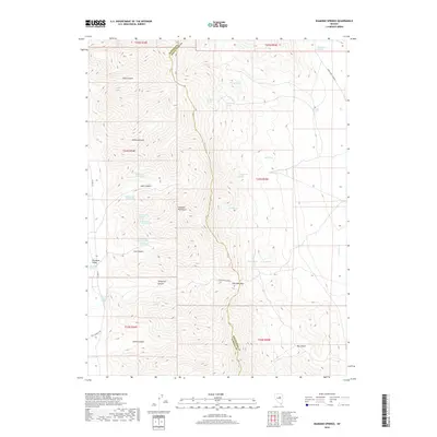
2018 Map of Diamond Springs
USGS Topo · Published 2018About this map
The Diamond Mountains dominate this high-desert landscape on the border of Eureka and White Pine counties. This area is defined by the historic corridor of the Pony Express Trl, which traverses the southern portion of the quadrangle near Horse Canyon. The map reveals a complex network of water sources vital for livestock and travel in this arid environment, including the numerous Echemendy springs and the Duck Pond. Historical ranching infrastructure is evident at Thompson Ranch and Diamond Springs, situated along the western edge where the mountains meet Diamond Valley. Travel across the range is funneled through Overland Pass and Telegraph Canyon, providing a clear view of how topography dictated the movement of goods and people across the Great Basin.
Find a feature on this map
41 named features on this map. Tap any name to fly to it.
Don’t see what you’re looking for? This feature index may not catch every label — zoom into the map to look around manually.
Map Details
Editions of this 2018 Diamond Springs Map
This is the sole edition of this map. No revisions or reprints were ever made.
Other maps of this area

1934 · Jiggs
USGS Topo · 1:125,000

1937 · Jiggs
USGS Topo · 1:125,000

1955 · Elko
USGS Topo · 1:250,000

1956 · Ely
USGS Topo · 1:250,000

1957 · Diamond Springs
USGS Topo · 1:62,500

1957 · Cold Creek Ranch
USGS Topo · 1:62,500

1958 · Elko
USGS Topo · 1:250,000

1959 · Ely
USGS Topo · 1:250,000

1959 · Railroad Pass
USGS Topo · 1:62,500

1959 · Sherman Mtn
USGS Topo · 1:62,500