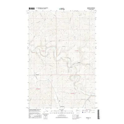
2017 Map of Diamond
USGS Topo · Published 2017About this map
The Palouse River carves a winding path through the rolling hills of Whitman County, providing a central corridor for local settlements. Small clusters of rural activity are centered around Diamond, Manning, and Harpole, connected by a network of local thoroughfares such as Green Hollow Rd and Manning Rd. The landscape is defined by extensive agricultural and topographical contours, with the broad basin of Rebel Flat and the drainage of Rebel Flat Cr shaping the southern portion of the survey. Local history is anchored by the Stipe Cem located near the river and the presence of the Mockonema area, reflecting a community pattern tied closely to the fertile geography and water access of the region.
Find a feature on this map
34 named features on this map. Tap any name to fly to it.
Don’t see what you’re looking for? This feature index may not catch every label — zoom into the map to look around manually.
Map Details
Editions of this 2017 Diamond Map
This is the sole edition of this map. No revisions or reprints were ever made.
Other maps of this area

1903 · Oakesdale
USGS Topo · 1:125,000

1905 · Oakesdale
USGS Topo · 1:125,000

1910 · Pullman
USGS Topo · 1:125,000

1950 · Endicott
USGS Topo · 1:62,500

1955 · Pullman
USGS Topo · 1:250,000

1955 · Spokane
USGS Topo · 1:250,000

1958 · Spokane
USGS Topo · 1:250,000

1958 · Pullman
USGS Topo · 1:250,000

1964 · Diamond
USGS Topo · 1:24,000

1964 · St. John
USGS Topo · 1:24,000