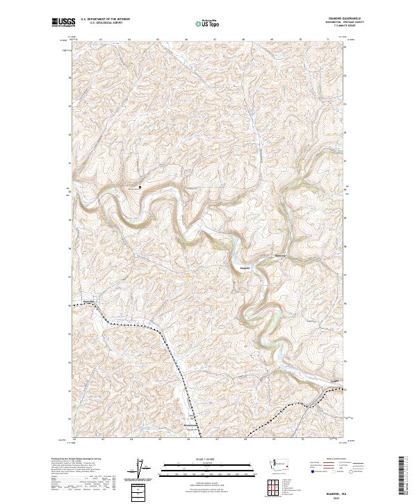
2023 Map of Diamond
USGS Topo · Published 2023About this map
The winding Palouse River carves a deep path through this Whitman County landscape, defining the rural character of a region known for its undulating wheat-growing terrain. Small settlements and loading points like Diamond, Manning, and Harpole dot the drainage basins, reflecting a long history of agricultural transport along the river and creek valleys. Near the southern edge of the sheet, the community of Mockonema sits within the broad Rebel Flat, where Rebel Flat Creek and Frog Creek converge.
Find a feature on this map
35 named features on this map. Tap any name to fly to it.
Don’t see what you’re looking for? This feature index may not catch every label — zoom into the map to look around manually.
Map Details
Editions of this 2023 Diamond Map
This is the sole edition of this map. No revisions or reprints were ever made.
Other maps of this area

1903 · Oakesdale
USGS Topo · 1:125,000

1905 · Oakesdale
USGS Topo · 1:125,000

1910 · Pullman
USGS Topo · 1:125,000

1950 · Endicott
USGS Topo · 1:62,500

1955 · Pullman
USGS Topo · 1:250,000

1955 · Spokane
USGS Topo · 1:250,000

1958 · Spokane
USGS Topo · 1:250,000

1958 · Pullman
USGS Topo · 1:250,000

1964 · Diamond
USGS Topo · 1:24,000

1964 · St. John
USGS Topo · 1:24,000