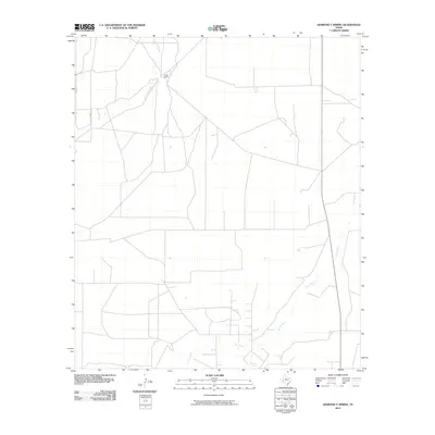
2010 Map of Diamond Y Spring
USGS Topo · Published 2010About this map
Diamond Y Spring and its surrounding desert landscape anchor this West Texas study, where water sources dictate the placement of human activity and infrastructure. The topography is defined by the ephemeral drainage of Courtney Creek in the northwest and the winding course of Leon Creek, which traverses the southern portion of the quadrangle. These watercourses are central to the ranching operations that characterize the region, including the established Lethco Ranch. The map reveals a sparse network of service roads and property boundaries typical of Pecos County's expansive cattle country. The proximity of these springs to the creeks highlights a critical environmental intersection in an otherwise arid environment, documenting the persistent value of natural water sources for livestock and habitation in this part of the Trans-Pecos.
Find a feature on this map
4 named features on this map. Tap any name to fly to it.
Don’t see what you’re looking for? This feature index may not catch every label — zoom into the map to look around manually.
Map Details
Editions of this 2010 Diamond Y Spring Map
This is the sole edition of this map. No revisions or reprints were ever made.
Other maps of this area

1921 · Fort Stockton
USGS Topo · 1:62,500

1923 · Fort Stockton
USGS Topo · 1:62,500

1928 · Comanche Spring
USGS Topo · 1:125,000

1929 · Hovey
USGS Topo · 1:125,000

1931 · Barstow
USGS Topo · 1:125,000

1954 · Pecos
USGS Topo · 1:250,000

1954 · Fort Stockton
USGS Topo · 1:250,000

1957 · Pecos
USGS Topo · 1:250,000

1958 · Fort Stockton
USGS Topo · 1:250,000

1970 · Fort Stockton West
USGS Topo · 1:24,000