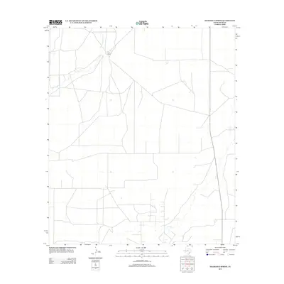
2012 Map of Diamond Y Spring
USGS Topo · Published 2012About this map
Diamond Y Spring emerges as the central landmark in this West Texas landscape within Pecos County. The terrain is defined by the ephemeral courses of Courtney Cr and Leon Cr, which weave through a sparse network of roads and property boundaries characteristic of the region's ranching economy. This early twenty-first-century survey captures the rural layout of the area, anchored by the Lethco Ranch to the north. The map reflects a landscape where water sources like the spring have historically dictated settlement and land use in an otherwise arid environment. Researchers will find a clear record of the modern infrastructure and drainage patterns that continue to shape this portion of the Trans-Pecos.
Find a feature on this map
4 named features on this map. Tap any name to fly to it.
Don’t see what you’re looking for? This feature index may not catch every label — zoom into the map to look around manually.
Map Details
Editions of this 2012 Diamond Y Spring Map
This is the sole edition of this map. No revisions or reprints were ever made.
Other maps of this area

1921 · Fort Stockton
USGS Topo · 1:62,500

1923 · Fort Stockton
USGS Topo · 1:62,500

1928 · Comanche Spring
USGS Topo · 1:125,000

1929 · Hovey
USGS Topo · 1:125,000

1931 · Barstow
USGS Topo · 1:125,000

1954 · Pecos
USGS Topo · 1:250,000

1954 · Fort Stockton
USGS Topo · 1:250,000

1957 · Pecos
USGS Topo · 1:250,000

1958 · Fort Stockton
USGS Topo · 1:250,000

1970 · Fort Stockton West
USGS Topo · 1:24,000