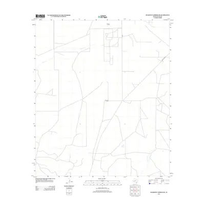
2012 Map of Diamond Y Spring SE
USGS Topo · Published 2012About this map
San Pedro Ranch sits in this desert landscape of Pecos County, where the sparse geography of West Texas is defined by vital water sources and industrial development. The drainage of Leon Cr and Comanche Cr provide the primary hydrological framework for the region, while San Simon Springs marks a specific point of interest in an otherwise arid environment. Economic activity is anchored in the north at the Chicklynn Oil Field, reflecting the long-standing petroleum heritage of the Permian Basin area. The transportation network is limited to a few key arteries, most notably FM 1053 and Buena Vista Rd, which serve the remote ranching operations and oil infrastructure that sustain the local economy.
Find a feature on this map
7 named features on this map. Tap any name to fly to it.
Don’t see what you’re looking for? This feature index may not catch every label — zoom into the map to look around manually.
Map Details
Editions of this 2012 Diamond Y Spring SE Map
This is the sole edition of this map. No revisions or reprints were ever made.
Other maps of this area

1921 · Fort Stockton
USGS Topo · 1:62,500

1923 · Fort Stockton
USGS Topo · 1:62,500

1928 · Comanche Spring
USGS Topo · 1:125,000

1954 · Pecos
USGS Topo · 1:250,000

1954 · Fort Stockton
USGS Topo · 1:250,000

1957 · Pecos
USGS Topo · 1:250,000

1958 · Fort Stockton
USGS Topo · 1:250,000

1970 · Fort Stockton West
USGS Topo · 1:24,000

1970 · East Mesa
USGS Topo · 1:24,000
1970 · Fort Stockton East
USGS Topo · 1:24,000