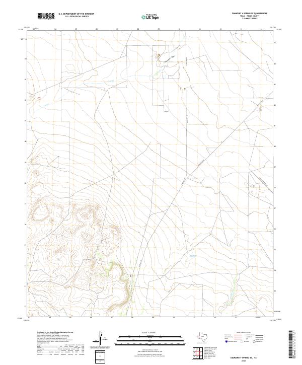
2022 Map of Diamond Y Spring SE
USGS Topo · Published 2022About this map
San Simon Springs provides a focal point in this arid Pecos County landscape, where subterranean water sources have long influenced the paths of regional transit and settlement. The map highlights a network of ephemeral watercourses including Leon Cr, Comanche Cr, and Diamond Y Draw, which shape the topography of this high desert terrain. These natural features are intersected by modern infrastructure, such as Ranch Rd 1053 and Buena Vista Rd, reflecting the historical transition from traditional cattle ranching routes to a landscape defined by energy and resource management. The inclusion of Texas Gulf Plant Rd underscores the region's industrial ties, marking the importance of sulfur or gas processing in this part of West Texas.
Find a feature on this map
7 named features on this map. Tap any name to fly to it.
Don’t see what you’re looking for? This feature index may not catch every label — zoom into the map to look around manually.
Map Details
Editions of this 2022 Diamond Y Spring SE Map
This is the sole edition of this map. No revisions or reprints were ever made.
Other maps of this area

1921 · Fort Stockton
USGS Topo · 1:62,500

1923 · Fort Stockton
USGS Topo · 1:62,500

1928 · Comanche Spring
USGS Topo · 1:125,000

1954 · Pecos
USGS Topo · 1:250,000

1954 · Fort Stockton
USGS Topo · 1:250,000

1957 · Pecos
USGS Topo · 1:250,000

1958 · Fort Stockton
USGS Topo · 1:250,000

1970 · Fort Stockton West
USGS Topo · 1:24,000

1970 · East Mesa
USGS Topo · 1:24,000
1970 · Fort Stockton East
USGS Topo · 1:24,000