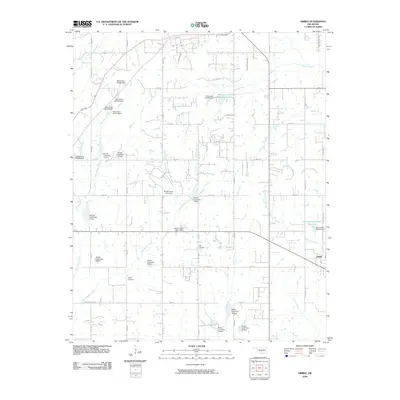
2009 Map of Dibble
USGS Topo · Published 2009About this map
Dibble anchors the southeastern corner of this central Oklahoma landscape, where the prairie is defined by a dense network of water management sites. The drainage basins of Walnut Creek, West Winter Creek, and East Winter Creek are shaped by numerous flood control structures, including the Oknoname 051028 Reservoir and the Oknoname 087034 Reservoir. These man-made features illustrate the mid-to-late 20th-century emphasis on watershed protection in the region's agricultural heartland.
Find a feature on this map
65 named features on this map. Tap any name to fly to it.
Don’t see what you’re looking for? This feature index may not catch every label — zoom into the map to look around manually.
Map Details
Editions of this 2009 Dibble Map
This is the sole edition of this map. No revisions or reprints were ever made.
Other maps of this area

1902 · Rush Springs
USGS Topo · 1:125,000

1904 · Chickasha
USGS Topo · 1:125,000

1949 · Rush Springs
USGS Topo · 1:62,500

1950 · Rush Springs
USGS Topo · 1:62,500

1954 · Oklahoma City
USGS Topo · 1:250,000

1957 · Ardmore
USGS Topo · 1:250,000

1957 · Oklahoma City
USGS Topo · 1:250,000

1963 · Ardmore
USGS Topo · 1:250,000

1963 · Oklahoma City
USGS Topo · 1:250,000
1965 · Newcastle
USGS Topo · 1:24,000