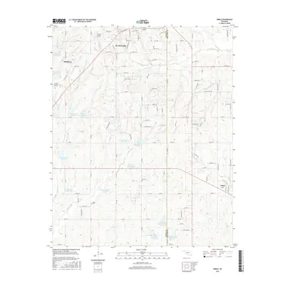
2016 Map of Dibble
USGS Topo · Published 2016About this map
Dibble and Middleberg anchor this central Oklahoma landscape, where the agricultural plains of Grady Co and McClain Co meet. The area is defined by an extensive water management network, featuring a dense concentration of flood control structures such as Winter Creek Site 1 Reservoir and several sites along Bitter Creek. These reservoirs dot a terrain carved by numerous drainages, including Walnut Creek and Criner Creek. Genealogists will find interest in the documented locations of Hale Cemetery and Naples Cemetery, while the road network shows the evolution of rural travel through various county roads and State Highway 9. The map captures the transition from traditional section-line roads to residential developments with avian-themed names like Kittyhawk Drive and Flamingo Drive near the northern boundary.
Find a feature on this map
113 named features on this map. Tap any name to fly to it.
Don’t see what you’re looking for? This feature index may not catch every label — zoom into the map to look around manually.
Map Details
Editions of this 2016 Dibble Map
This is the sole edition of this map. No revisions or reprints were ever made.
Other maps of this area

1902 · Rush Springs
USGS Topo · 1:125,000

1904 · Chickasha
USGS Topo · 1:125,000

1949 · Rush Springs
USGS Topo · 1:62,500

1950 · Rush Springs
USGS Topo · 1:62,500

1954 · Oklahoma City
USGS Topo · 1:250,000

1957 · Ardmore
USGS Topo · 1:250,000

1957 · Oklahoma City
USGS Topo · 1:250,000

1963 · Ardmore
USGS Topo · 1:250,000

1963 · Oklahoma City
USGS Topo · 1:250,000
1965 · Newcastle
USGS Topo · 1:24,000