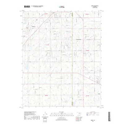
2018 Map of Dibble
USGS Topo · Published 2018About this map
The boundary between Grady and McClain counties bisects a landscape defined by small settlements and a dense network of country roads. Near the northern edge, the community of Middleberg and the Rock Ridge Airport sit amidst a series of managed water bodies, including Bitter Cr Site 15 Reservoir and Bitter Cr Site 16 Reservoir. Further south, the town of Dibble is situated near the confluence of Dibble Cr and Criner Cr, while the larger center of Blanchard occupies the eastern portion of the map.
Find a feature on this map
98 named features on this map. Tap any name to fly to it.
Don’t see what you’re looking for? This feature index may not catch every label — zoom into the map to look around manually.
Map Details
Editions of this 2018 Dibble Map
This is the sole edition of this map. No revisions or reprints were ever made.
Other maps of this area

1902 · Rush Springs
USGS Topo · 1:125,000

1904 · Chickasha
USGS Topo · 1:125,000

1949 · Rush Springs
USGS Topo · 1:62,500

1950 · Rush Springs
USGS Topo · 1:62,500

1954 · Oklahoma City
USGS Topo · 1:250,000

1957 · Ardmore
USGS Topo · 1:250,000

1957 · Oklahoma City
USGS Topo · 1:250,000

1963 · Ardmore
USGS Topo · 1:250,000

1963 · Oklahoma City
USGS Topo · 1:250,000
1965 · Newcastle
USGS Topo · 1:24,000