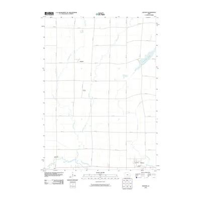
2010 Map of Dickens
USGS Topo · Published 2010About this map
The Little Sioux River and its meandering tributaries dominate this portion of Clay County, Iowa, reflecting a landscape defined by glacial drainage and agricultural development. The town of Dickens serves as a local hub near the southern border, where the Dickens Post Office and Dickens Cemetery anchor the community history. To the north, the smaller settlements of Langdon and Prospect align with the rigid section-line grid of rural roads such as 250th Ave and 280th St, showing the intersection of natural waterways and human engineering.
Find a feature on this map
30 named features on this map. Tap any name to fly to it.
Don’t see what you’re looking for? This feature index may not catch every label — zoom into the map to look around manually.
Map Details
Editions of this 2010 Dickens Map
This is the sole edition of this map. No revisions or reprints were ever made.
Other maps of this area

1954 · Fairmont
USGS Topo · 1:250,000

1958 · Fairmont
USGS Topo · 1:250,000

1966 · Spencer
USGS Topo · 1:24,000

1966 · Gillett Grove
USGS Topo · 1:24,000

1966 · Greenville
USGS Topo · 1:24,000

1966 · Dickens
USGS Topo · 1:24,000

1970 · Milford
USGS Topo · 1:24,000

1970 · Spirit Lake SE
USGS Topo · 1:24,000

1972 · Terril
USGS Topo · 1:24,000
1972 · Silver Lake
USGS Topo · 1:24,000