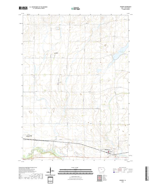
2022 Map of Dickens
USGS Topo · Published 2022About this map
The town of Dickens serves as the focal point for this section of Clay County, situated just east of the expansive drainage systems that feed into the Little Sioux River. This landscape is defined by its glacial hydrology, where slow-moving waters like Dan Green Slough and the Lost Island Outlet weave through a network of section-line roads and agricultural tracts. These water features, alongside Big Muddy Cr and Little Muddy Cr, reflect the prairie pothole character of the region, where drainage patterns were critical to the development of early farming settlements.
Find a feature on this map
42 named features on this map. Tap any name to fly to it.
Don’t see what you’re looking for? This feature index may not catch every label — zoom into the map to look around manually.
Map Details
Editions of this 2022 Dickens Map
This is the sole edition of this map. No revisions or reprints were ever made.
Other maps of this area

1954 · Fairmont
USGS Topo · 1:250,000

1958 · Fairmont
USGS Topo · 1:250,000

1966 · Spencer
USGS Topo · 1:24,000

1966 · Gillett Grove
USGS Topo · 1:24,000

1966 · Greenville
USGS Topo · 1:24,000

1966 · Dickens
USGS Topo · 1:24,000

1970 · Milford
USGS Topo · 1:24,000

1970 · Spirit Lake SE
USGS Topo · 1:24,000

1972 · Terril
USGS Topo · 1:24,000
1972 · Silver Lake
USGS Topo · 1:24,000