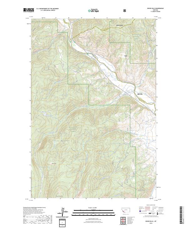
2024 Map of Dickie Hills
USGS Topo · Published 2024About this map
The Big Hole River winds through the heart of this southwestern Montana landscape, marking the confluence of several vital alpine drainages. Situated within the Beaverhead National Forest, the terrain rises into the distinctive Dickie Hills and the northern reaches of the Pioneer Mountains. The presence of Butte (labeled as a settlement feature near the river) and named tracts such as Heart Park reflect the intersection of public land management and local land use.
Find a feature on this map
54 named features on this map. Tap any name to fly to it.
Don’t see what you’re looking for? This feature index may not catch every label — zoom into the map to look around manually.
Map Details
Editions of this 2024 Dickie Hills Map
This is the sole edition of this map. No revisions or reprints were ever made.
Other maps of this area

1893 · Dillon
USGS Topo · 1:250,000

1955 · Dillon
USGS Topo · 1:250,000

1957 · Dillon
USGS Topo · 1:250,000

1958 · Dillon
USGS Topo · 1:250,000

1958 · Vipond Park
USGS Topo · 1:62,500
1961 · Dickie Peak
USGS Topo · 1:24,000

1961 · Wise River
USGS Topo · 1:24,000

1962 · Dillon
USGS Topo · 1:250,000

1962 · Lincoln Gulch
USGS Topo · 1:24,000

1962 · Lower Seymour Lake
USGS Topo · 1:24,000