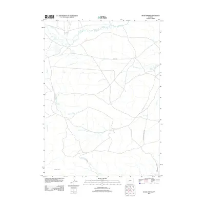
2012 Map of Dickie Springs
USGS Topo · Published 2012About this map
Oregon Buttes anchor the southern portion of this landscape, overlooking a network of historic migration paths and desert water sources. This high plains region is defined by the winding course of the Sweetwater River and its numerous seasonal tributaries, including Dickie Springs Cr and Meadow Cr. The map preserves the alignment of the Emigrant Trl, a vital artery for westward travelers that follows the natural contours of the basin toward the Continental Divide. Remote outposts like Hay Ranch and essential watering holes such as Dickie Springs, Oregon Spring, and Edmund Springs mark the few points of human activity and survival in this arid terrain. Further south, the Point of Rocks S Pass Stage Rte traces the logistical history of the Wyoming Territory, connecting old mining districts and railheads to the mountain passes.
Find a feature on this map
18 named features on this map. Tap any name to fly to it.
Don’t see what you’re looking for? This feature index may not catch every label — zoom into the map to look around manually.
Map Details
Editions of this 2012 Dickie Springs Map
This is the sole edition of this map. No revisions or reprints were ever made.
Other maps of this area

1953 · Atlantic City
USGS Topo · 1:24,000

1953 · South Pass City
USGS Topo · 1:24,000

1955 · Lander
USGS Topo · 1:250,000

1958 · Lander
USGS Topo · 1:250,000

1958 · Pacific Springs
USGS Topo · 1:24,000

1958 · Freighter Gap
USGS Topo · 1:62,500

1958 · The Pinnacles
USGS Topo · 1:62,500

1958 · Dickie Springs
USGS Topo · 1:24,000

1958 · Continental Peak
USGS Topo · 1:24,000

1961 · Lander
USGS Topo · 1:250,000