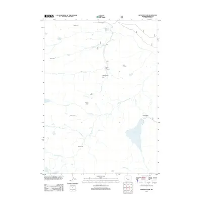
2012 Map of Dickinson Park
USGS Topo · Published 2012About this map
Dickinson Park serves as a central hub for high-altitude exploration in this part of Fremont County, situated at the terminus of Moccasin Lake Rd. The landscape is defined by the headwaters of the N Popo Agie River and the significant basin of Shoshone Lake to the south. This area is a complex of peaks and meadows, with landmarks like Black Mountain and Hobbs Peak rising above the watershed.
Find a feature on this map
26 named features on this map. Tap any name to fly to it.
Don’t see what you’re looking for? This feature index may not catch every label — zoom into the map to look around manually.
Map Details
Editions of this 2012 Dickinson Park Map
This is the sole edition of this map. No revisions or reprints were ever made.
Other maps of this area

1937 · Moccasin Lake
USGS Topo · 1:48,000

1943 · Moccasin Lake
USGS Topo · 1:62,500

1952 · Wind River
USGS Topo · 1:24,000

1953 · Sweetwater Gap
USGS Topo · 1:24,000

1953 · Cony Mountain
USGS Topo · 1:24,000

1953 · Mount Arter
USGS Topo · 1:24,000

1955 · Lander
USGS Topo · 1:250,000

1958 · Lander
USGS Topo · 1:250,000

1961 · Lander
USGS Topo · 1:250,000
1969 · Temple Peak
USGS Topo · 1:24,000