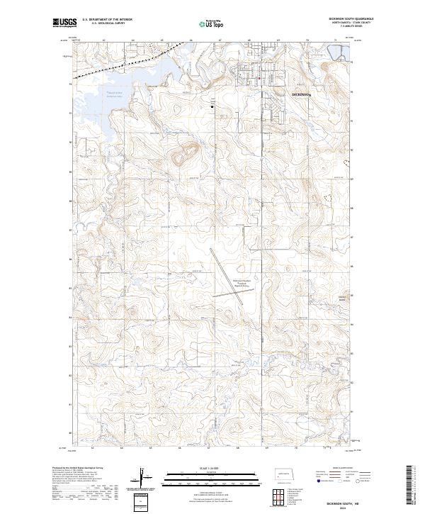
2024 Map of Dickinson South
USGS Topo · Published 2024About this map
The Heart River winds through this North Dakota landscape just south of the growing city of Dickinson, feeding into the expansive Edward Arthur Patterson Lake. This 2024 survey captures a region defined by the transition from urban edge to the high plains of Stark County. The southern expansion of the city is evident near Saint Joseph Cem, while the central portion of the map is anchored by the Dickinson/Theodore Roosevelt Regional Airport, a critical infrastructure point for the western part of the state.
Find a feature on this map
37 named features on this map. Tap any name to fly to it.
Don’t see what you’re looking for? This feature index may not catch every label — zoom into the map to look around manually.
Map Details
Editions of this 2024 Dickinson South Map
This is the sole edition of this map. No revisions or reprints were ever made.
Other maps of this area

1953 · Dickinson
USGS Topo · 1:250,000

1957 · Dickinson
USGS Topo · 1:250,000

1959 · Dickinson North
USGS Topo · 1:24,000

1959 · Dickinson South
USGS Topo · 1:24,000

1959 · Lehigh
USGS Topo · 1:24,000

1962 · Davis Buttes
USGS Topo · 1:24,000

1973 · Lefor NW
USGS Topo · 1:24,000

1973 · New Hradec South
USGS Topo · 1:24,000

1973 · New England NW
USGS Topo · 1:24,000

1973 · Schefield
USGS Topo · 1:24,000